
News:
June 1 2009:
I have added information on the June 4, 2005 outbreak. I need to still add chase accounts for this event.. Also working on the November 2005 event. Links on that event are not correct, yet.
March 1, 2009:
I have added several newspaper articles for the 1980-1990 time frame. I also added a higher resolution tornado track map (thank you NWS Indianapolis) for the June 2, 1990 outbreak.
August 06, 2008:
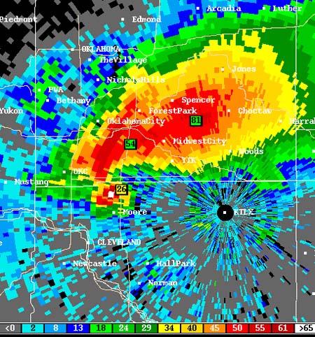
I have added more than 10,000 images from the March 4, 2004 high risk event. A special thanks to Chris Howell for provided the images. You can view the page at this location.
August 02, 2008:
I have added several
newspaper articles to the April 26, 1991, tornado outbreak.
July 28, 2008:
Added several Storm Track threads to the archive. Still searching the site for more data.
Fixed the "hyper" link problem. If you click on a link it should open a new page. The only pages not fixed are the NCEP map pages. I will have to work on those.
Added several more newspaper articles.
Fixed several "missing" web-sites to new sites with the chase logs intact.
July 27, 2008:
You must have the latest version of Firefox for this site to work properly. At least version 3.0.1. It may take some time in order to fix the problems with the older versions of firefox.
Added an event for 1992. I also need to fix the site so that links bring up a new page when clicked upon.
An event from 1992 is missing. This has been brought to my attention from a forum poster. I am looking into it.
Added 3 newspaper articles for the November 16, 1989 outbreak.
July 25, 2008:Added July 22, 2008, bird migration from KPAH Radar.
Added numerous videos for the remainder of the high risk events. I am now finished with the first attempt at locating tornado videos from 1999-2005. I need to continue searching even further back (also need to check other sites).
July 24, 2008:
Added numerous videos through 1999.
Added 36 videos of different high risk event tornadoes. Working through the 1980-1995 events. Slowly adding videos as I find them.
I have corrected the HTML issues. It took awhile but I finally figured out where the error was.
Added 600 images and links from the Storm Prediction Center. The information will include all high risk events from the year 2000 through 2005. Included in the information are regional observation loops, Skew-T/Log-P plots, 12 UTC Observed Soundings, 00 UTC Observed Soundings, upper air analysis, surface/radar/satellite data, also added additional links to day 1 outlooks and meso-scale discussions.
The following dates need to
be added to the database:
2005: June 4, November 15th.
2006: March 12, April 6, April 7th.
2007: March 1, April 13, April 24, May 5, June 7th.
2008: February 5, March 15, May 22, May 29th, June 5th.
I will add them in the coming weeks.
I have added additional Wikipedia information/links. These links will take you to outbreak reviews. I am also looking for YouTube (or other sites) video of high risk tornado events.
July 23, 2008:
Added historical weather maps
to each date.
Having some formatting problems with the page size. Some browsers
are not properly showing the size of the tables. Working on the
issue.
I have completed every year from 1990 through 2005. There should
not be any missing "dates" but could be some missing data. Still
pulling it together.
Corrected several hundred link errors or missing map links. I will
have to search for the maps to see if they are available from other
sources. Some maps are simply n/a from the NCEP or other
government databases.
July 22, 2008:
Added Wikipedia articles to each outbreak event. Will continue to search for additional articles from other news sources.
Added a FAQ section to the site.
I need to go through all of the map pages. There
are a number of missing images or broken links. The majority of
the links are working, but there are some problems with certain years.
It will take some time to go through them. I will have to reload
what is available and check against what I have posted onto the site.
There are several thousand links to check.
July
21, 2008:
Rewrote the HTML for the entire site.
July 14, 2008:
Added 700 maps for
2002-2004.
Finished round one of adding maps.
There are numerous map links that have maps "missing". I need to either replace the link with a valid image or unlink it and show a n/a text. I may have to go online and find some different sources for archived weather maps. Some maps are simply missing from NCEP.
I am also looking into adding satellite images. At some point, over the next month or two, I am going to add area forecast discussions and additional text data.
July 13, 2008:
Added over a thousand of NCEP maps for 1999-2002.
July 12, 2008:
Added forty-five maps for
January 20, 1999.
Added approximately 900 weather maps to the
1999 archive.
July 11, 2008:
Added sixty weather maps for May 29-June 01 of 1998.
Added sixty weather maps for June 13-15 of 1998.
July 10, 2008:
Added Wisconsin bow echo event.
Added examples of radar ducting.
July 9, 2008:
Added sixty weather maps for April 15-17th of 1998.
July 8, 2008:
Added overshooting top
satellite photo examples to events.
July 6, 2008:
Added sixty weather maps for
April 7th-9th of 1998.
Added sixty weather maps for April 14-16th of
1998.
July 5, 2008:
Changed the 2003 page and took away all the 2004 events. The 2004 events are now on the 2004-2006 events page. There are a number of missing events that still need to be added. I also believe there could be some 2000-2001 events missing. I am still researching that subject.
I have numerous weather maps to add to the archive. Each day has approximately 20 maps available. I am adding the day before and the day after to each event. This will total 60 weather maps per high risk day. This means there are over a thousand weather maps to add. It will take some time.
I am also looking into satellite data for each event.
I am also working on changing the original lay-out of the early
high risk pages. I am still not certain how I am going to
re-design this. Most likely something a bit more organized.
Some of the pages are fairly lengthy. I have tried to condense
some of the information onto other pages (not having the radar data on
the main page and moving those links to a stand alone page).
July 1, 2008:
Added several hundred radar images
June 15, 2008:
Started adding weather maps for each outbreak.
June 10, 2008:
I am starting to add "severe weather illustrations" to the events page. Over time I would like to have illustrations of radar, satellite, and weather data to compare with an actual storm event. This section of the web-site is meant to be educational. Additional suggestions or comments/corrections are always welcome.
March/April 2008:
Registered the web site to host the high risk
archive. I first started gathering the data about a year ago.
I have finally found enough to time to move forward on the project.
March/April 2007:
Starting working on the idea of reconstructing the high risk web site that Andy Wehrle put together and hosted. Worked on adding additional links and gathering information on high risk days.
More Information on the high risk archive:
Several years ago the Andy Wehrle's "High Risk" web-site was hacked and the data was destroyed. With Andy's help, I am reconstructing the web-site. We will also be adding additional data to the older pages and will update the site to include more recent high risk events.
Links are always welcome and if you have particular information on an outbreak then please email me at the address below.